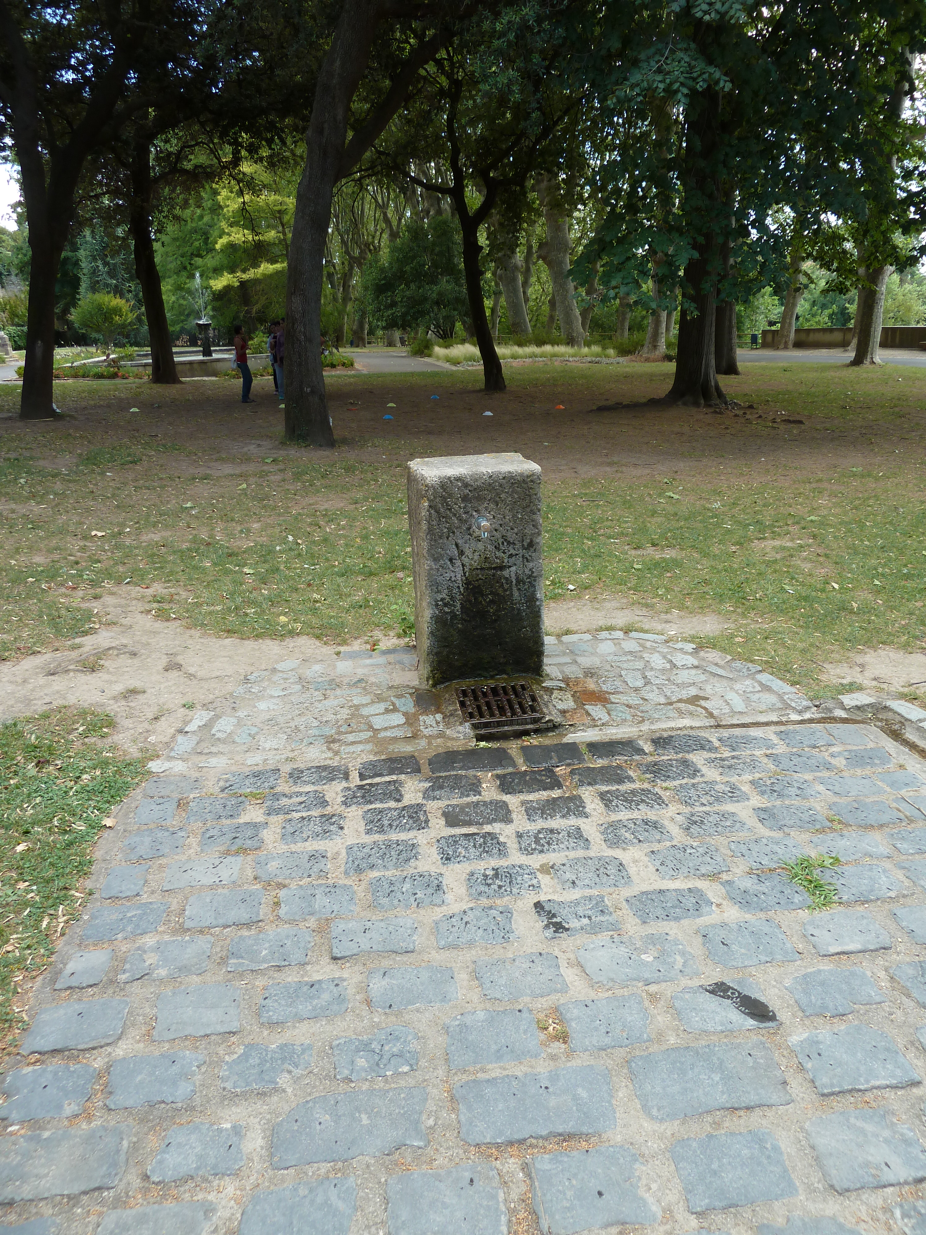
Fontaine eau potable Jardin de la Plantade
- Beschrijving
-
Parc ouvert 7/7 (aux heures d'ouverture naturellement). Sur les bords de l'Orb, à la sortie de Béziers en direction de Murviel.
Accès au Moulin Cordier (servait à pomper l'eau pour la ville haute).
La fontaine se situe au milieu du parc. - Bron- of kraanwater
- Kraanwater
- Honden kom
- Onbekend
- Flessen bijvulstation
- Onbekend
- Goedgekeurd door overheidsinstanties
- Onbekend
- Land
- Frankrijk
- Stad
- Béziers
- Adres
- Jardin de la Plantade, Béziers, 34500
- steden in de buurt
-
- Cers (34420)
- Magalas (34480)
- Vinassan (11110)
- Caux (34720)
- Colombiers (34440)
- Montblanc (34290)
- Thézan-lès-Béziers (34490)
- Portiragnes (34420)
- Portiragnes (34450)
- Puisserguier (34620)
- GPS coördinaten
-
- Breedtegraad
- 43.344244059952
- Lengtegraad
- 3.2077348232274
- Graden minuten
- N 43° 20.655', E 3° 12.464'
- Ingezonden door
-
yoh34500
- Aanmaakdatum
- 2016-07-14 21:28:23
- Datum voor het laatst bijgewerkt
- 2016-07-20 20:58:07
Kaart
Foto's
In de buurt
| Naam | Type | Stad | Afstand |
|---|---|---|---|
| Fontaine eau potable Allées Paul Riquet | Kraan | Béziers | 1 km |
| Fontaine eau potable n°1 - Parc Plateau des Poètes | Kraan | Béziers | 1 km |
| Fontaine eau potable n°2 - Parc Plateau des Poètes | Kraan | Béziers | 1 km |
| Fontaine eau potable - piste cyclable qui longe le Canal du Midi | Kraan | Béziers | 2 km |
| Fontaine eau potable Parc sportif de Tabarka | Kraan | Lignan-sur-Orb | 4 km |
| Piste cyclable Canal du Midi | Kraan | Villeneuve-lès-Béziers | 7 km |
| Fontaine eau potable Sérignan | Kraan | Sérignan | 9 km |
| Piste cyclable Canal du Midi | Kraan | Portiragnes | 11 km |
| Fontaine publique eau potable Valras Plage | Kraan | Valras-Plage | 13 km |
| Fontaine eau potable - Portiragnes Plage | Kraan | Portiragnes | 14 km |
| Fontaine publique eau potable / Pézenas | Kraan | Pézenas | 22 km |
| Fontaine eau potable - Pézenas | Kraan | Pézenas | 22 km |
| Fontaine eau potable - Pézenas | Kraan | Pézenas | 22 km |
| Fontaine eau potable - Pézenas | Kraan | Pézenas | 22 km |
| Source | Lente | Les Aires | 28 km |