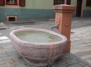
| Fontaine rue du Bois |
Lente |
Bergholtz−Zell |
3 km |
| Fontaine de l'église |
Kraan |
Guebwiller |
6 km |
| Borne Eau |
Kraan |
Guebwiller |
6 km |
| Fontaine rue Principale |
Lente |
Lautenbach |
6 km |
| Fontaine rue de la Paix |
Lente |
Lautenbach |
6 km |
| Fontaine de l'église |
Lente |
Lautenbach |
6 km |
| Fontaine de la Mairie |
Lente |
Lautenbach-Zell |
7 km |
| Fontaine Grand rue 1 |
Lente |
Lautenbach-Zell |
7 km |
| Fontaine de la Route Forestière du Boenlesgrab |
Lente |
Lautenbach |
7 km |
| Fontaine Grand rue 2 |
Lente |
Lautenbach-Zell |
7 km |
| Fontaine rue du Wasen |
Lente |
Lautenbach-Zell |
7 km |
| Fontaine du cimetière |
Kraan |
Linthal |
8 km |
| Fontaine du Monument aux Morts |
Lente |
Linthal |
8 km |
| Fontaine de la Mairie |
Lente |
Linthal |
8 km |
| Fontaine rue des Prés |
Lente |
Linthal |
9 km |
| Source de Wattwiller |
Lente |
Wattwiller |
15 km |
| Source de Wattwiller |
Lente |
Wattwiller |
15 km |
