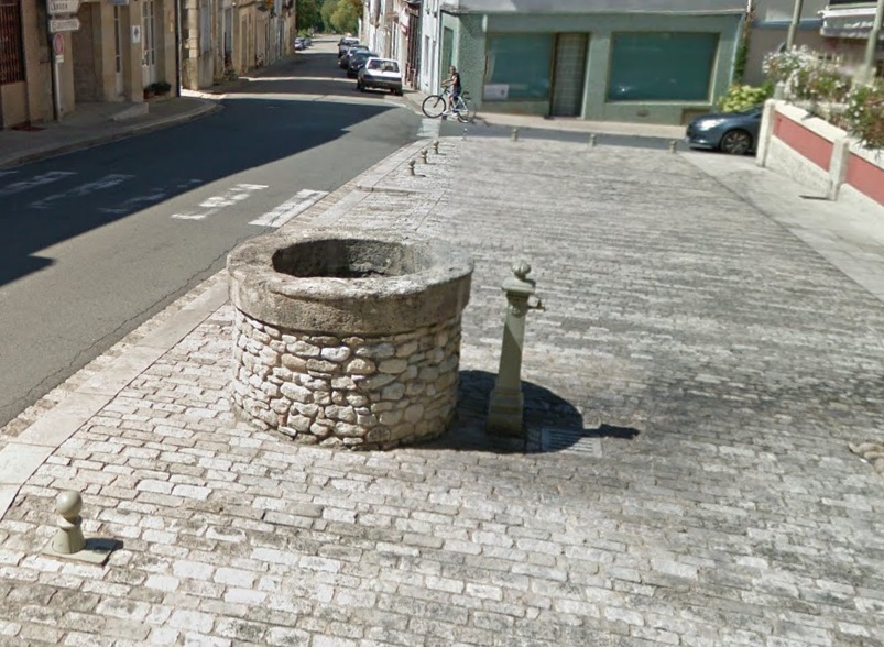
Robinet Pellegrue place de la mairie
- Beschrijving
- Robinet sur le trottoir place de la mairie
- Bron- of kraanwater
- Kraanwater
- Honden kom
- Onbekend
- Flessen bijvulstation
- Onbekend
- Goedgekeurd door overheidsinstanties
- Onbekend
- Laatste goedgekeurde datum
- 21/08/2021
- Land
- Frankrijk
- Postcode
- 33790
- Stad
- Pellegrue
- Adres
- Rue de la République 17
- steden in de buurt
-
- Port-Sainte-Foy-et-Ponchapt (33220)
- Castillon-la-Bataille (33350)
- Sainte-Foy-la-Grande (33220)
- La Réole (33190)
- La Réole (33191 CEDEX)
- La Réole (33192 CEDEX)
- La Réole (33193 CEDEX)
- GPS coördinaten
-
- Breedtegraad
- 44.74337913747
- Lengtegraad
- 0.075574819608684
- Graden minuten
- N 44° 44.603', E 0° 4.534'
- Ingezonden door
-
AchilleTendon
- Aanmaakdatum
- 2021-08-22 14:17:46
- Datum voor het laatst bijgewerkt
- 2021-08-25 11:40:03
Kaart
Foto's
In de buurt
| Naam | Type | Stad | Afstand |
|---|---|---|---|
| Robinet Abbaye de Blasimon | Kraan | Blasimon | 12 km |
| Robinet cimeterre Mérignas | Kraan | Mérignas | 14 km |
| Cimetière Sainte Foix La Grande | Kraan | Pineuilh | 15 km |
| Robinet du cimetiere de Fougueyrolles | Kraan | Fougueyrolles | 16 km |
| Robinet du cimetiere de Mongauzy | Kraan | Mongauzy | 20 km |
| Robinet La Réole | Kraan | La Réole | 20 km |
| Robinet mairie Villefranche-de-Lonchat | Kraan | Villefranche-de-Lonchat | 23 km |
| Fontaine de Mourens | Kraan | Mourens | 25 km |