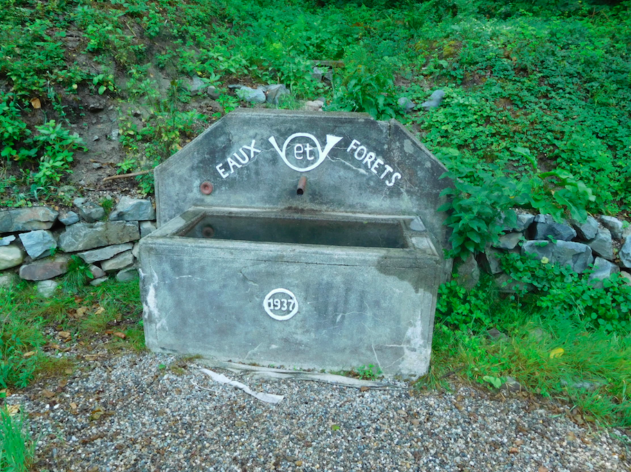
Fontaine de la Route Forestière du Boenlesgrab
This water place has been reported as non-potable water!
- Spring or tap water
- Spring water
- Dog bowl
- No
- Bottle refill station
- No
- Approved by public authorities
- Unknown
- Country
- France
- City
- Lautenbach
- Address
- Linthal, France
- Nearby cities
-
- Ammerschwihr (68770)
- Ammerschwihr (68410)
- Labaroche (68910)
- Soultzmatt (68570)
- Bitschwiller-lès-Thann (68620)
- Pulversheim (68840)
- Saint-Amarin (68550)
- Kaysersberg (68240)
- Vieux-Thann (68800)
- Vieux-Thann (68806 CEDEX)
- GPS coordinates
-
- Latitude
- 47.9530569573
- Longitude
- 7.14403124549
- Degrees minutes
- N 47° 57.183', E 7° 8.642'
- OpenStreetMap node
-
- Submitted by
-
- Created date
- 2017-07-22 18:45:17
- Last updated date
- 2023-11-08 18:55:05

Map
Photos
Nearby
| Name | Type | City | Distance |
|---|---|---|---|
| Fontaine du cimetière | Tap | Linthal | 1 kms |
| Fontaine rue du Wasen | Spring | Lautenbach-Zell | 1 kms |
| Fontaine Grand rue 2 | Spring | Lautenbach-Zell | 1 kms |
| Fontaine du Monument aux Morts | Spring | Linthal | 1 kms |
| Fontaine de la Mairie | Spring | Linthal | 1 kms |
| Fontaine Grand rue 1 | Spring | Lautenbach-Zell | 1 kms |
| Fontaine de la Mairie | Spring | Lautenbach-Zell | 1 kms |
| Fontaine rue des Prés | Spring | Linthal | 1 kms |
| Fontaine de l'église | Spring | Lautenbach | 2 kms |
| Fontaine rue Principale | Spring | Lautenbach | 2 kms |
| Fontaine rue de la Paix | Spring | Lautenbach | 2 kms |
| Borne Eau | Tap | Guebwiller | 6 kms |
| Fontaine de l'église | Tap | Guebwiller | 7 kms |
| Fontaine rue du Bois | Spring | Bergholtz−Zell | 7 kms |
| Fontaine rue des Boulangers | Spring | Soultzmatt | 7 kms |
| Source de Wattwiller | Spring | Wattwiller | 14 kms |
| Source de Wattwiller | Spring | Wattwiller | 14 kms |