Source de Wattwiller
- Description
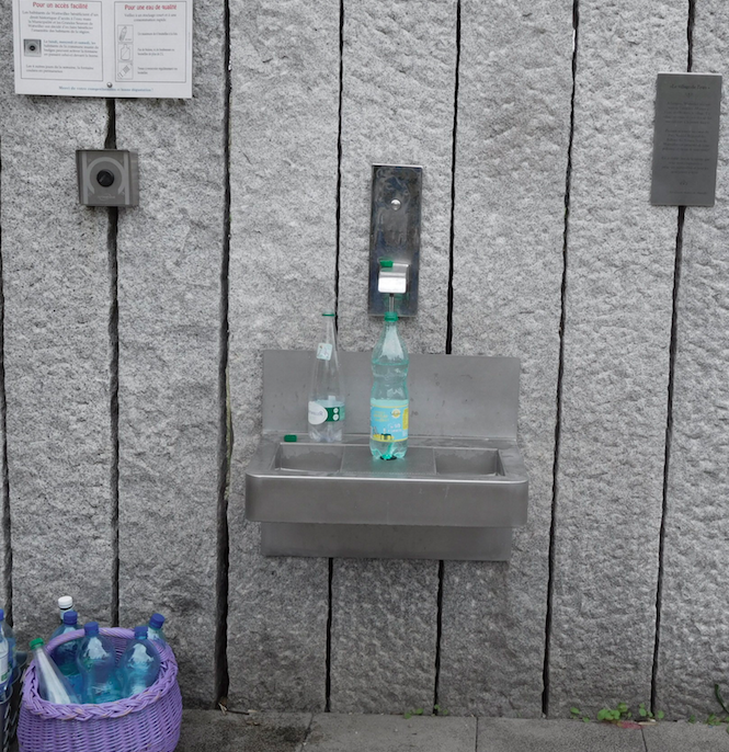
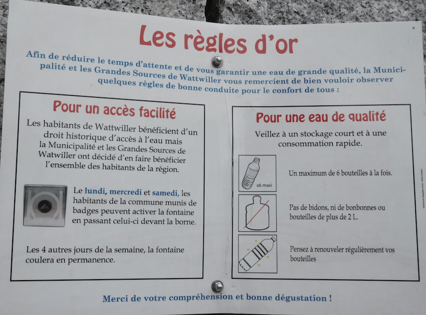
- Eau de Wattwiller, en direct de l'usine d'embouteillage. Usage réservé aux habitants munis d'un badge les lundis, mercredis et samedis. Coule normalement le reste du temps.
- Spring or tap water
- Spring water
- Dog bowl
- No
- Bottle refill station
- Yes
- Approved by public authorities
- Yes
- Country
- France
- City
- Wattwiller
- Address
- Wattwiller, France
- Nearby cities
-
- Illfurth (68720)
- Dannemarie (68210)
- Soultzmatt (68570)
- Bitschwiller-lès-Thann (68620)
- Baldersheim (68390)
- Pulversheim (68840)
- Zillisheim (68720)
- Saint-Amarin (68550)
- Morschwiller-le-Bas (68790)
- Ruelisheim (68270)
- GPS coordinates
-
- Latitude
- 47.829145867461
- Longitude
- 7.1846852981739
- Degrees minutes
- N 47° 49.749', E 7° 11.081'
- OpenStreetMap node
-
- amenity
- drinking_water
- name
- Source de Wattwiller
- ref:refuges.info
- 6561
- Submitted by
-
- Created date
- 2017-07-31 18:04:23
- Last updated date
- 2023-11-08 18:55:05

Map
Photos
Nearby
| Name | Type | City | Distance |
|---|---|---|---|
| Source de Wattwiller | Spring | Wattwiller | 0 kms |
| Fontaine de l'église | Tap | Guebwiller | 9 kms |
| Borne Eau | Tap | Guebwiller | 9 kms |
| Fontaine rue du Bois | Spring | Bergholtz−Zell | 12 kms |
| Fontaine rue de la Paix | Spring | Lautenbach | 12 kms |
| Fontaine rue Principale | Spring | Lautenbach | 13 kms |
| Fontaine de l'église | Spring | Lautenbach | 13 kms |
| Fontaine de la Mairie | Spring | Lautenbach-Zell | 13 kms |
| Fontaine Grand rue 1 | Spring | Lautenbach-Zell | 13 kms |
| Fontaine Grand rue 2 | Spring | Lautenbach-Zell | 13 kms |
| Fontaine rue du Wasen | Spring | Lautenbach-Zell | 13 kms |
| Fontaine du cimetière | Tap | Linthal | 13 kms |
| Fontaine du Monument aux Morts | Spring | Linthal | 14 kms |
| Fontaine de la Mairie | Spring | Linthal | 14 kms |
| Fontaine de la Route Forestière du Boenlesgrab | Spring | Lautenbach | 14 kms |
| Fontaine rue des Prés | Spring | Linthal | 14 kms |
| Fontaine rue des Boulangers | Spring | Soultzmatt | 15 kms |
| Eau de source | Spring | Giromagny | 28 kms |